ARCHAEOLOGICAL SITES
AIGAI
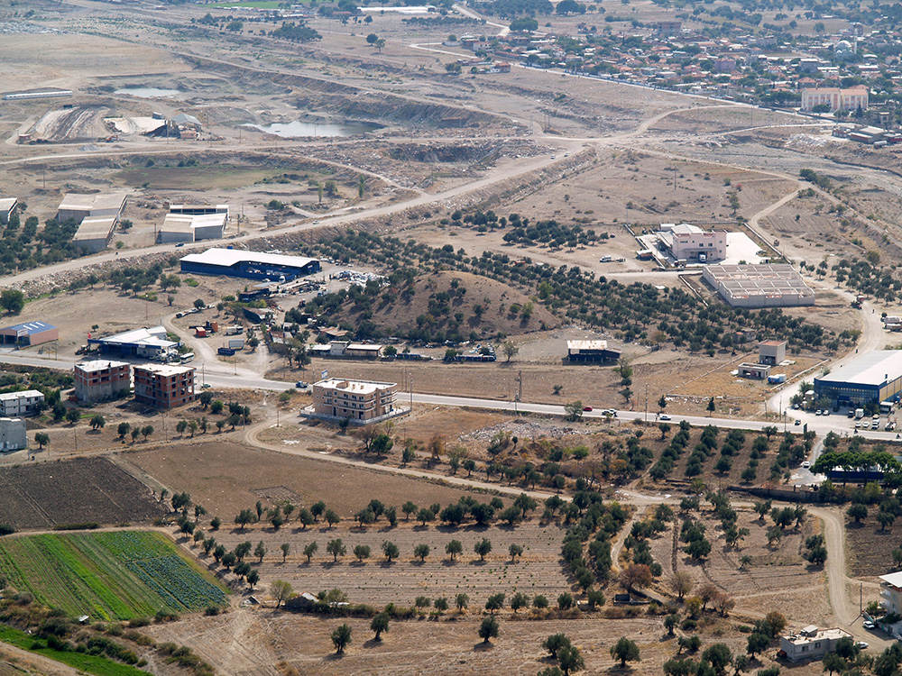
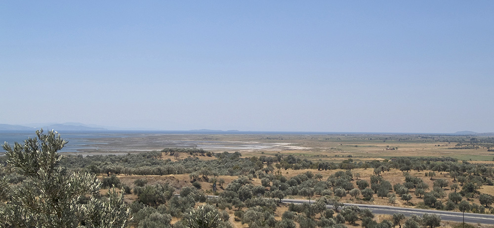
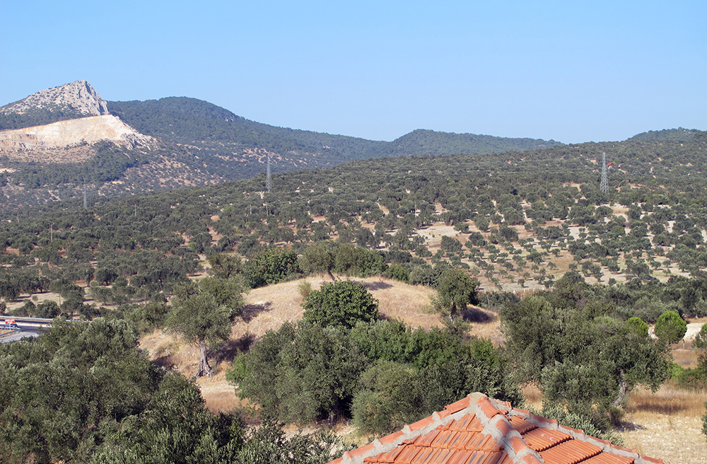
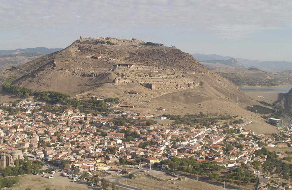
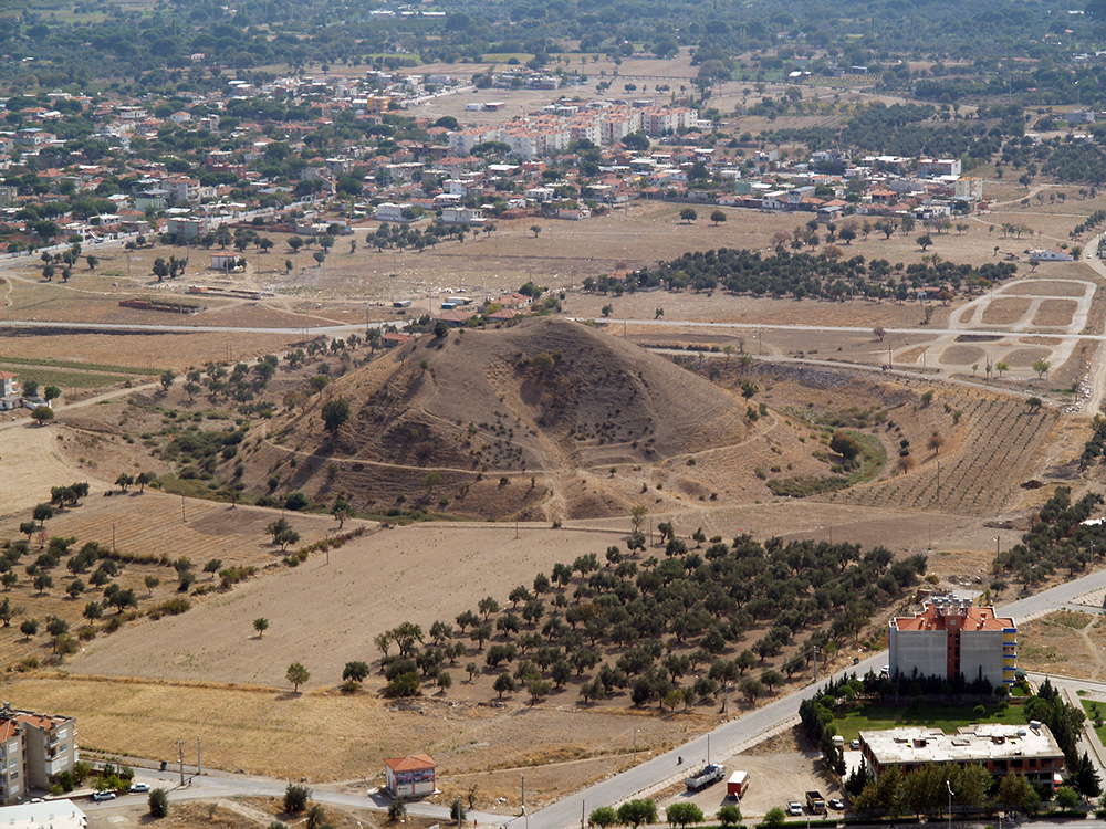
The ancient city of Aigai is located 2 km south of the village of Yuntdağıköseler in the Yunusemre district of Manisa, Turkey, 45 km distant from the city center of Manisa and 14 km from Yenişakran which is at the coast of the Aegean Sea. Herodotus mentions Aigai as one of the 12 poleis founded by the Aeolians who came to Anatolia after 1100 BC. For now, however, results of the archaeological excavations show that the foundation of the city goes only back to the late 8th century BC. From the beginning of the 3rd century BC, also with the support of the Hellenistic Kingdom of Pergamon, Aigai became an economic and cultural centre, an attraction point for the surrounding region and grew into the capital of the Yunt Mountains (Aspordenon) territory. Inside the city, in addition to public buildings – namely the theatre, the council house (bouleuterion), the agora with a well maintained market building, a macellum, stoai, baths, a gymnasium and temples – there are also other elements of an ancient city like city walls, domestic buildings, an industrial area and the necropolis.
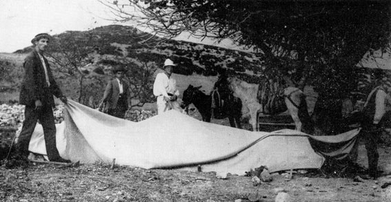
The initial research on Aigai was undertaken by S. Reinach and W. M. Ramsay in 1881. One year later, in 1882, M. A. Clerc carried out the first excavations in the necropolis of Aigai. Shortly afterwards, in 1886, R. Bohn and C. Schuchhardt conducted and published a detailed architectural survey in the city. Current research and excavations in Aigai are carried out since 2004 under the direction of Prof. Dr. Ersin Doğer on behalf of the Ministry of Culture and Tourism of the Republic of Turkey.
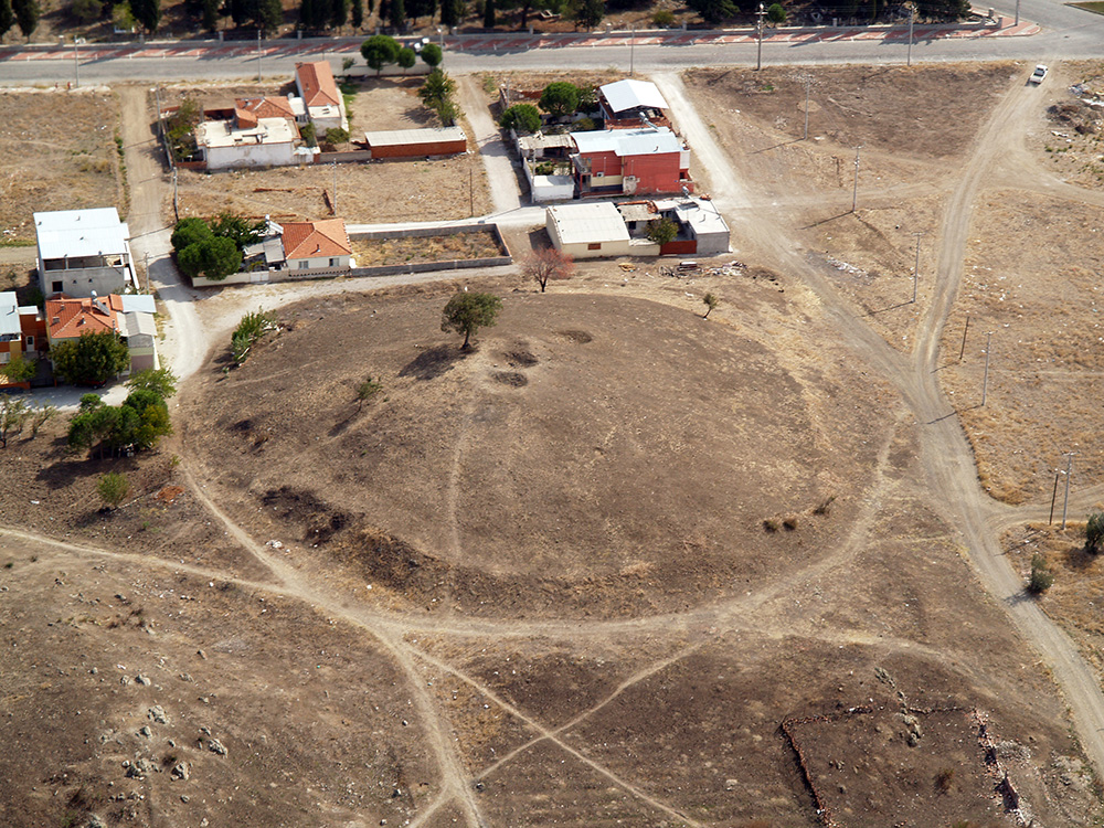
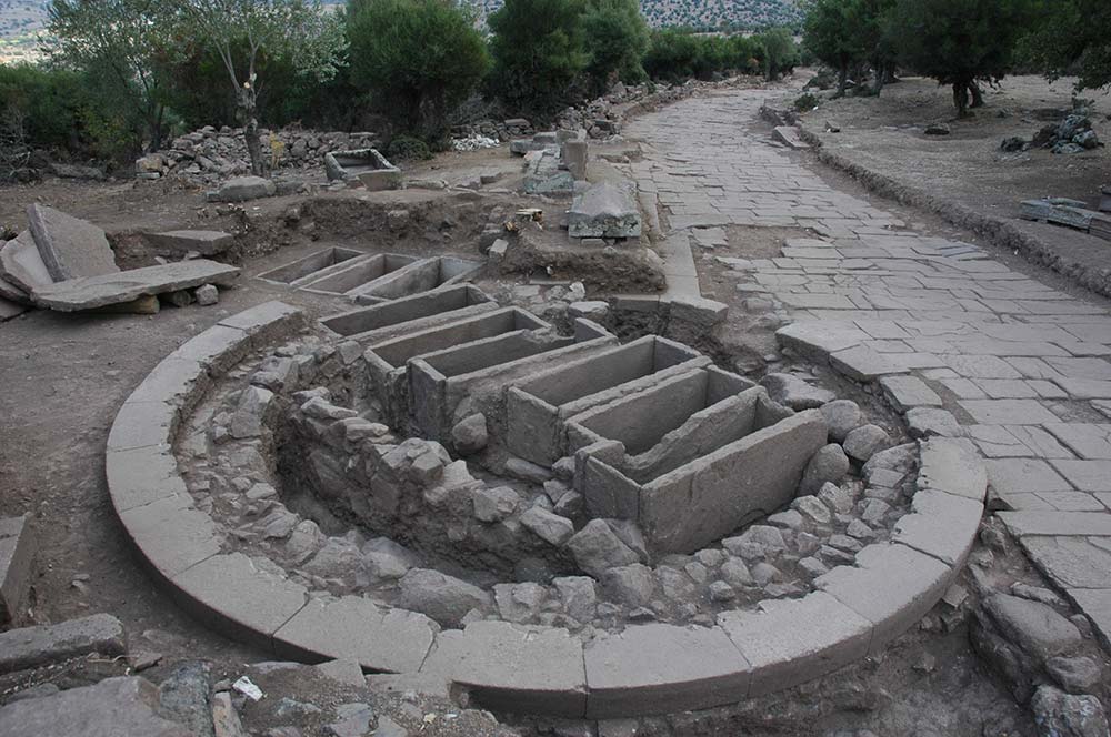
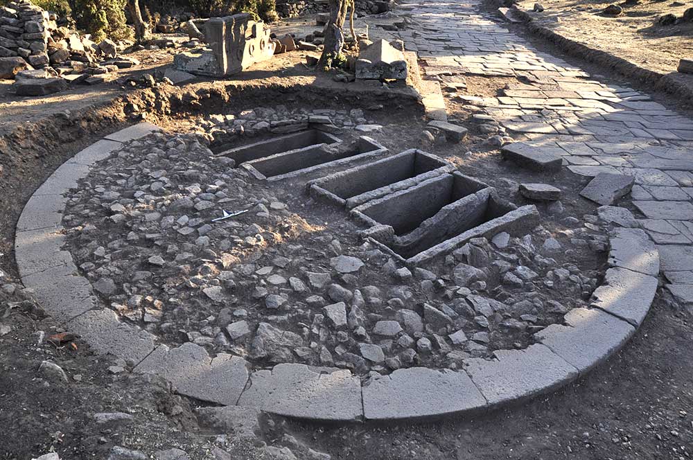
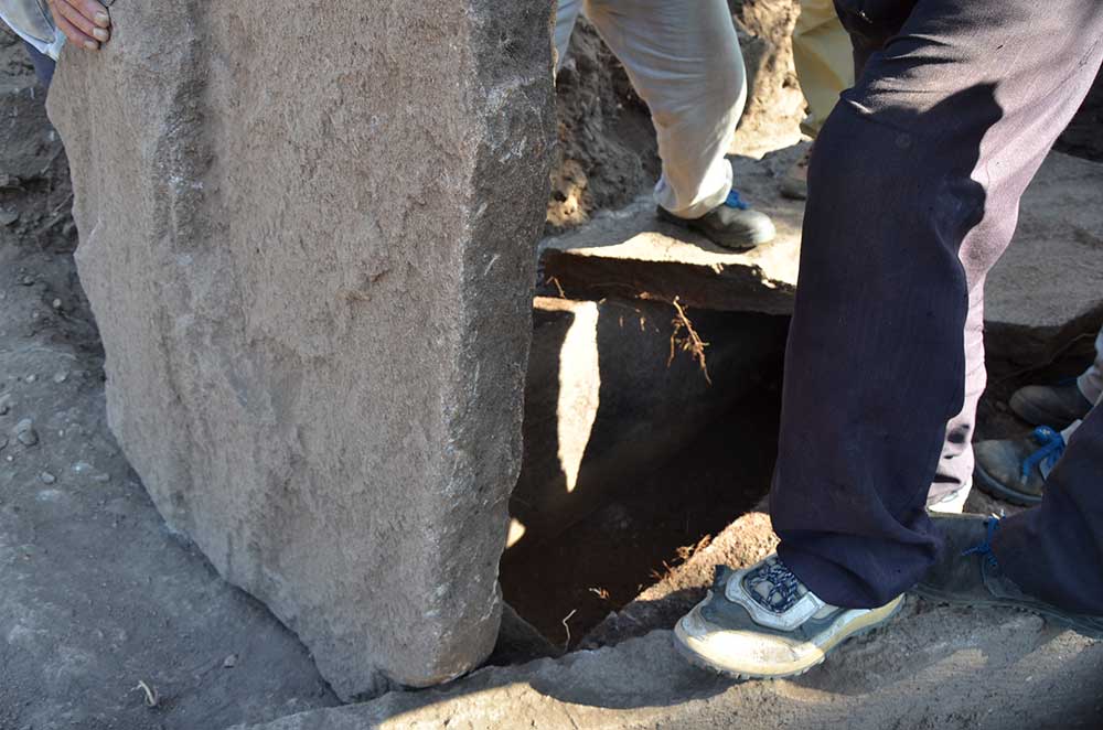
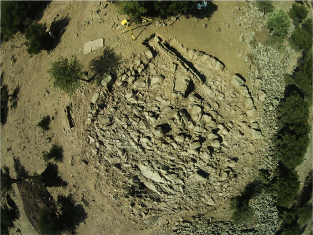
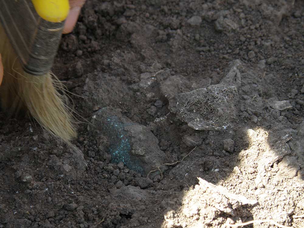
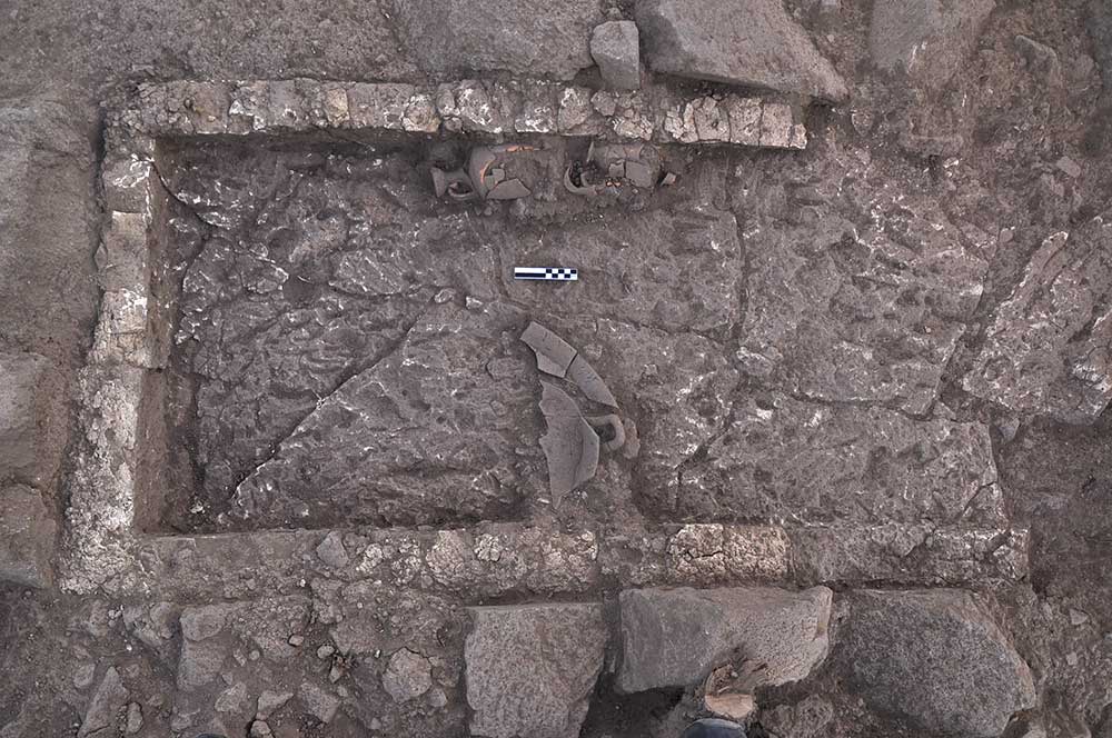
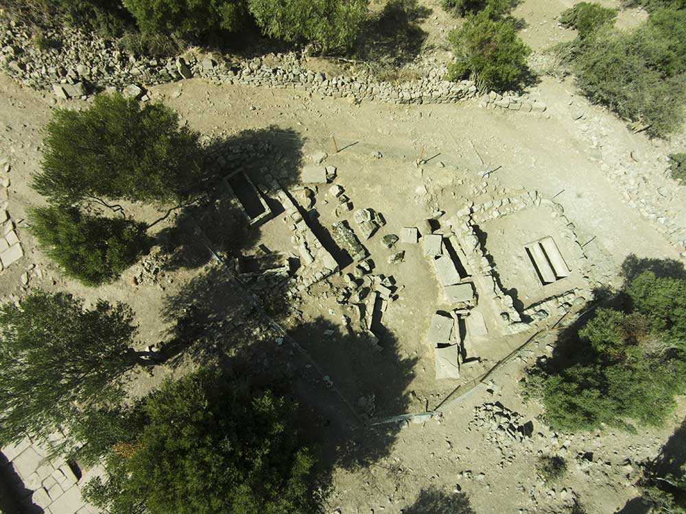
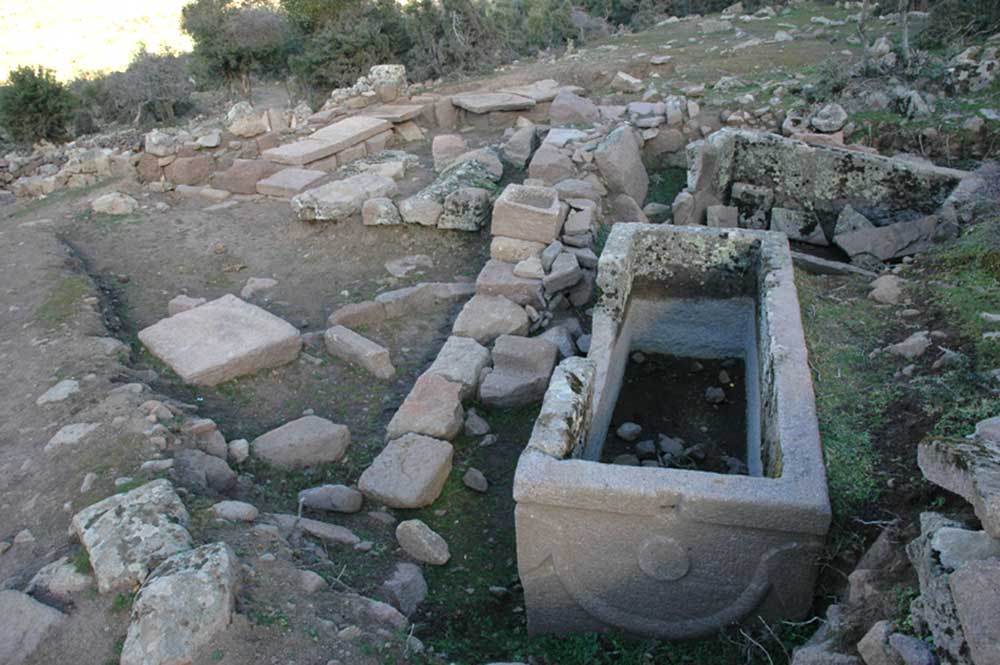
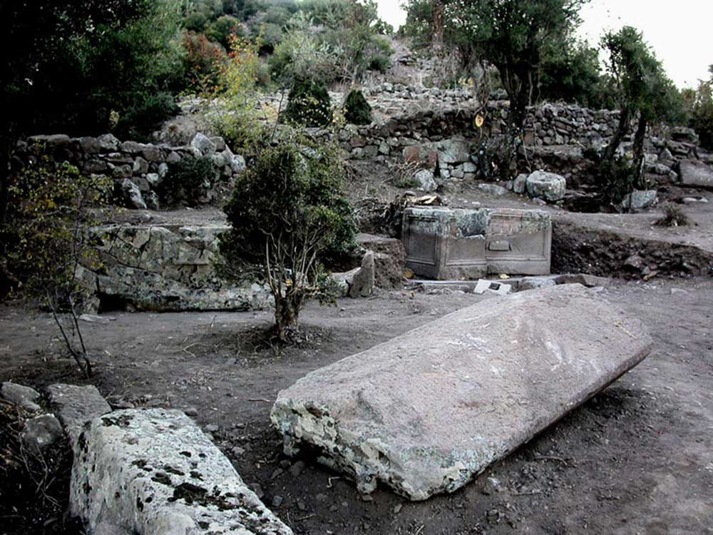
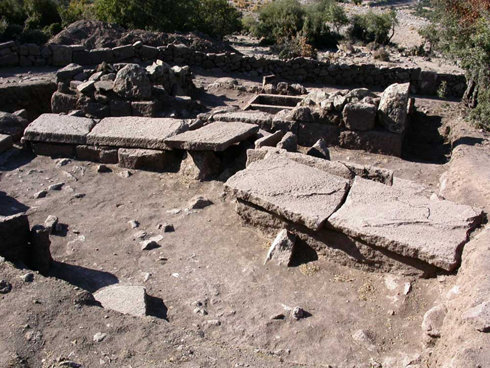
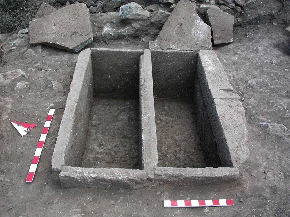
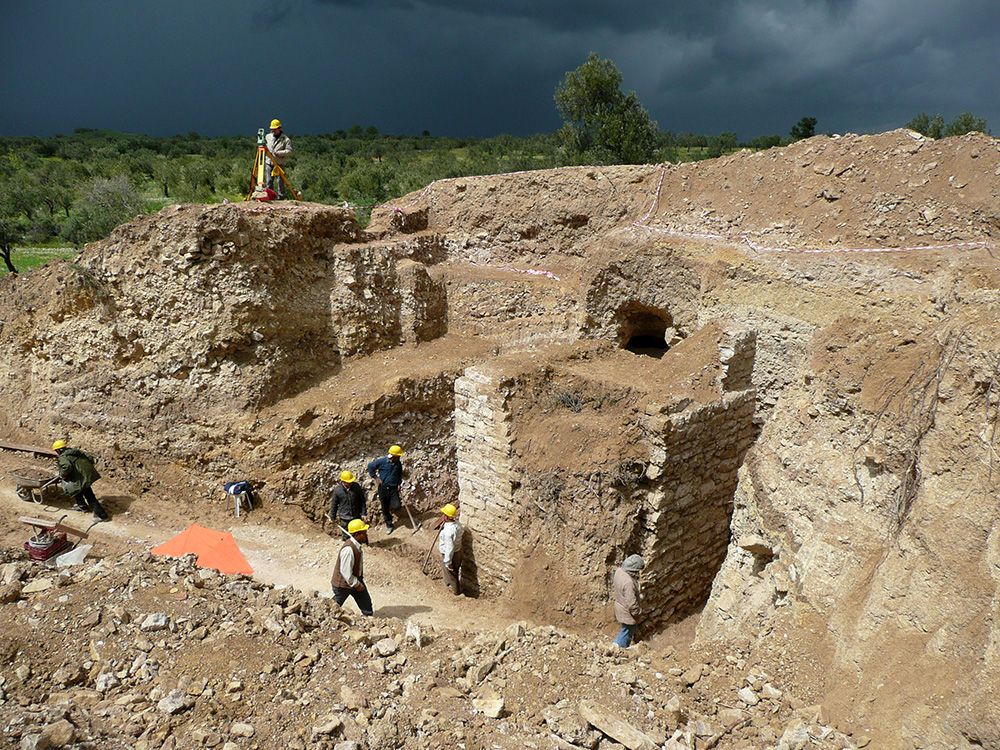
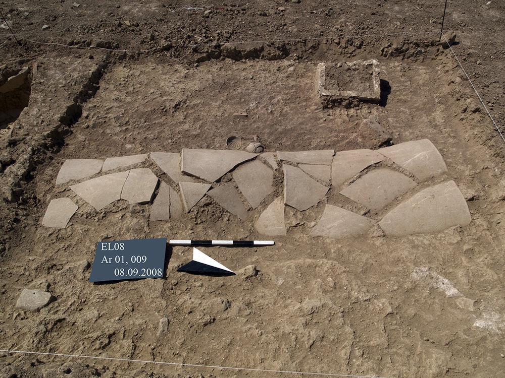
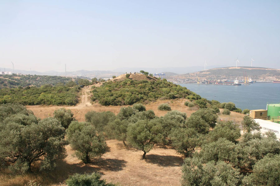
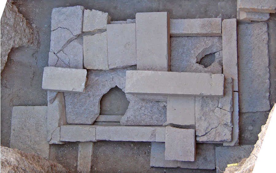
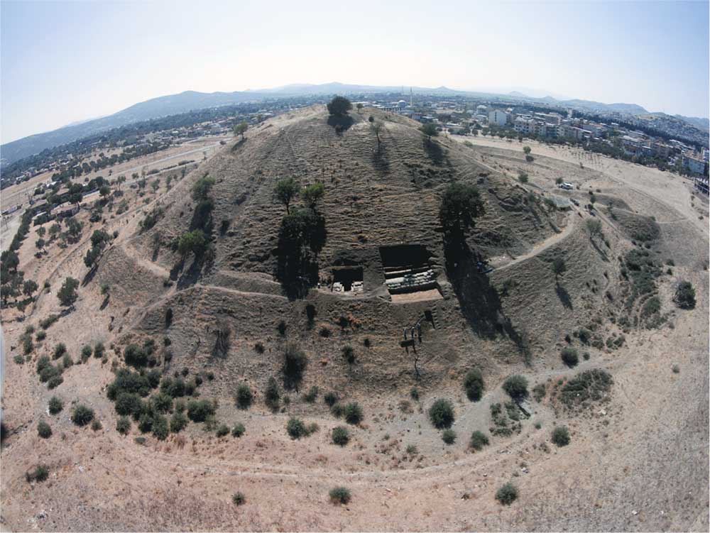
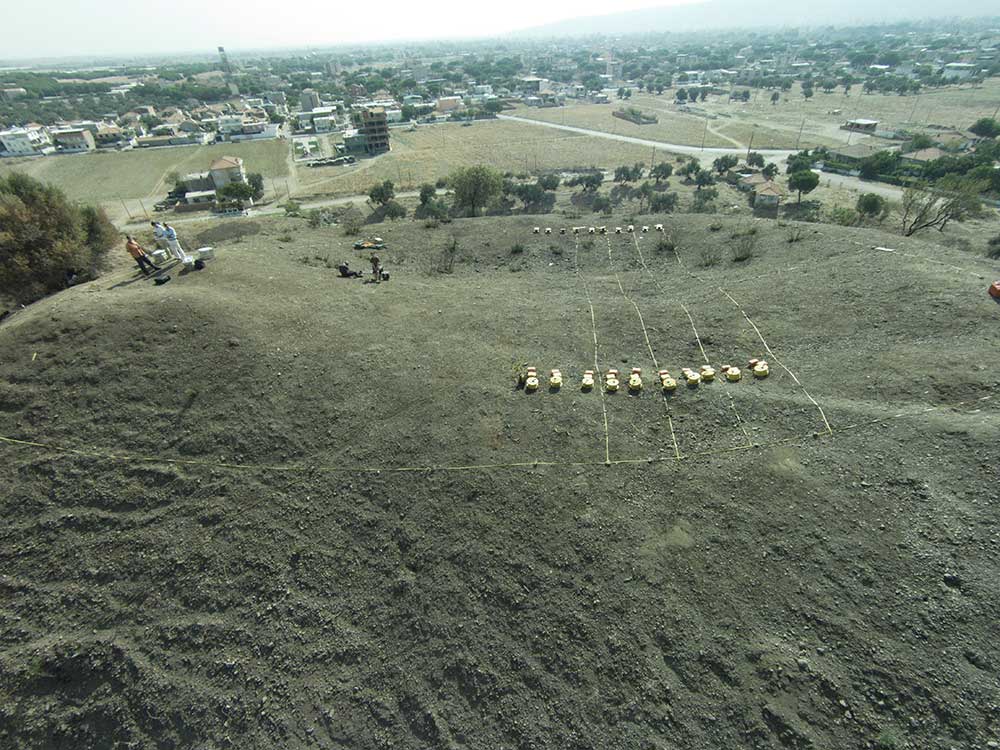
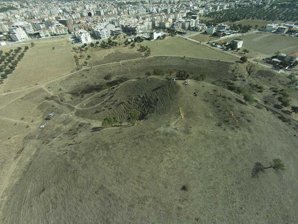
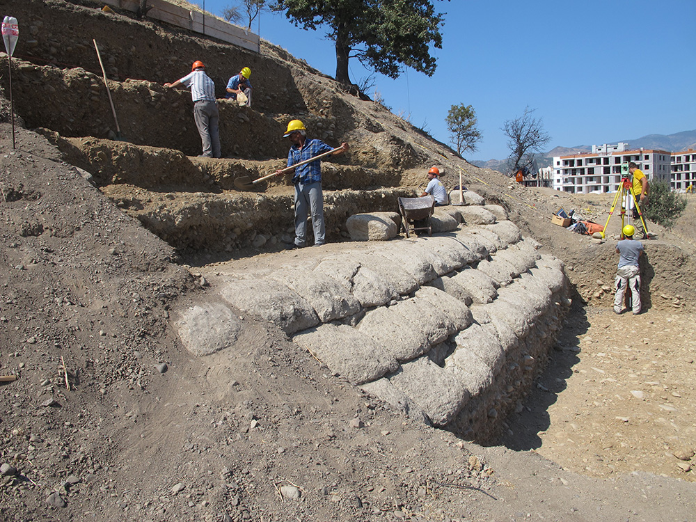
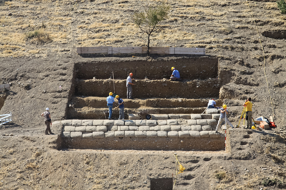
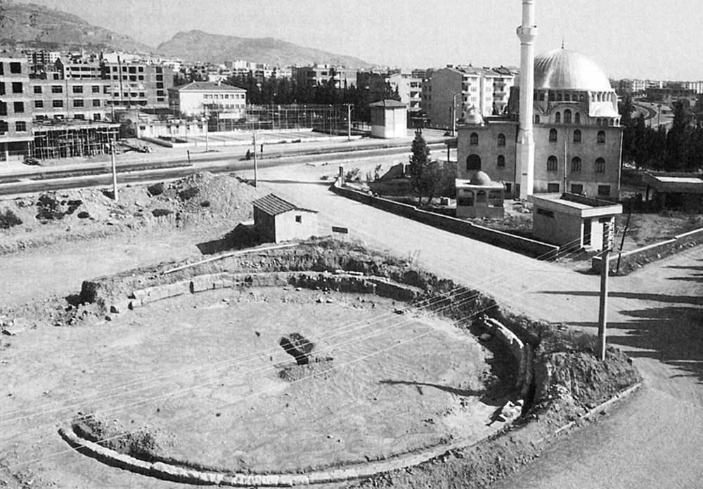
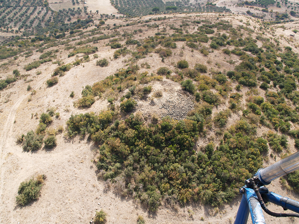
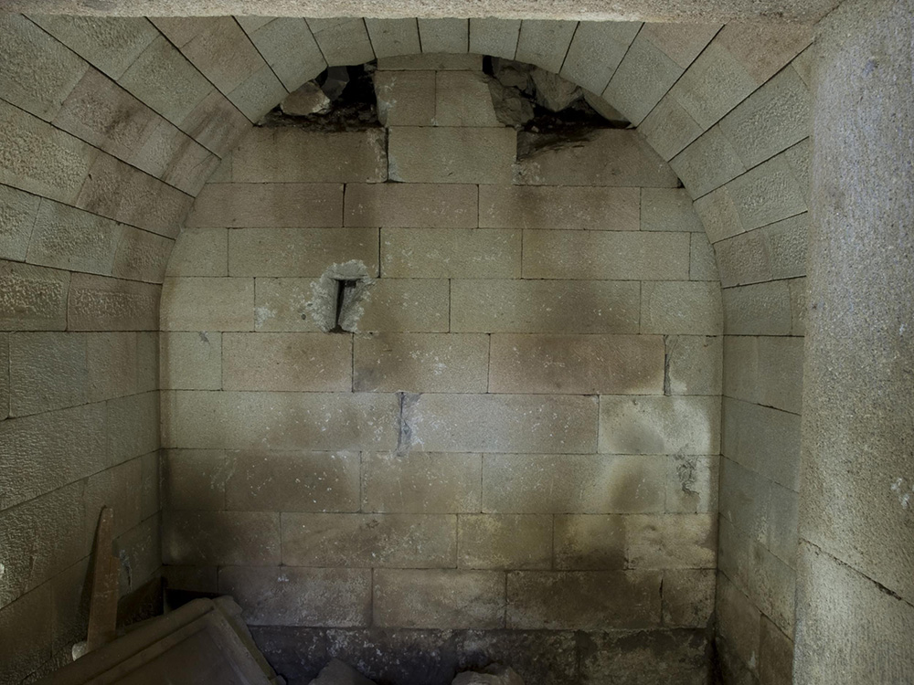
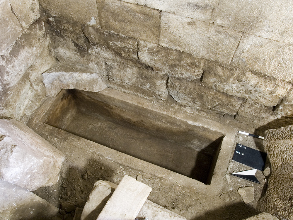
During the 2015 archaeological season in Aigai a field and architectural survey, excavations as well as geophysical and anthropological-palaeopathological examinations took place as part of the NekroPergEol-project. In 2015, the necropolis survey covered an area of 1,7 hectares while the entire area of the necropolis extends on approximately 20 hectares. As a result of the survey, numerous funerary monuments, podia, various other types of tombs, stelai and architectural fragments have been identified and recorded. The excavation of the tumulus at the highest point of the mountain range of the necropolis revealed that it was erected at the end of the 8th century or in the early 7th century BC, and it contained about 10 cremation burials from that period. Furthermore, subsequent to the Archaic Period the tumulus was used again for different burials and rituals during Classical, Hellenistic and Roman times. Another excavation was carried out in a circular funerary monument which is located near the ancient road into the city that is passing through the necropolis. These investigations resulted in the reconstruction of a monument crowned with a concave three-facing top. Underneath the circular monument 6 cist graves have been found. The monument was probably built at the beginnnig of the 1st century BC for Diaphenes, a prominent euergetes of the city, and his family.
Circular monument

The Tumulus
The roman necropolis
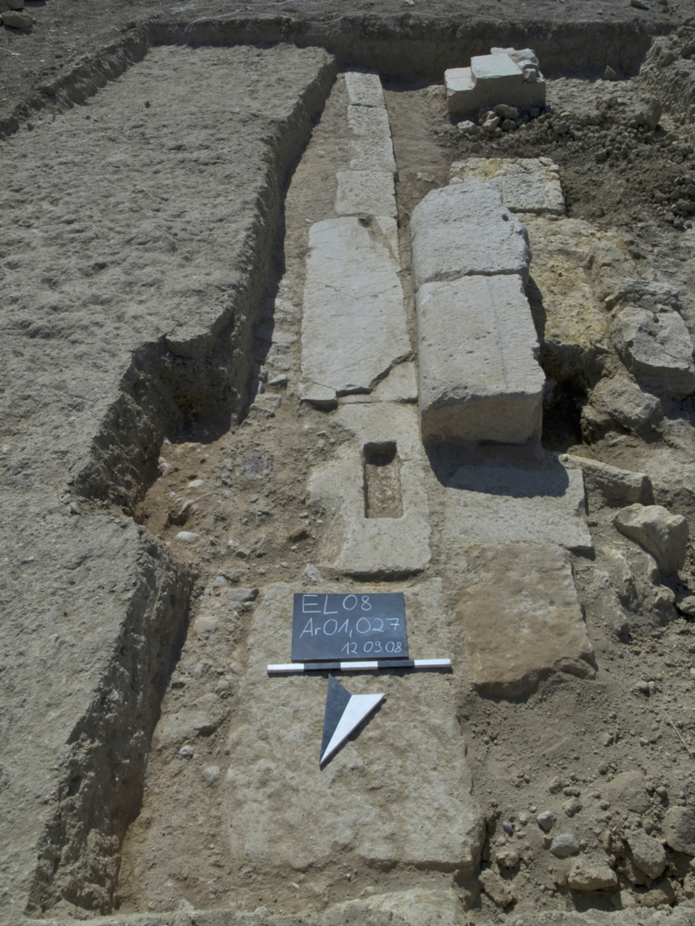
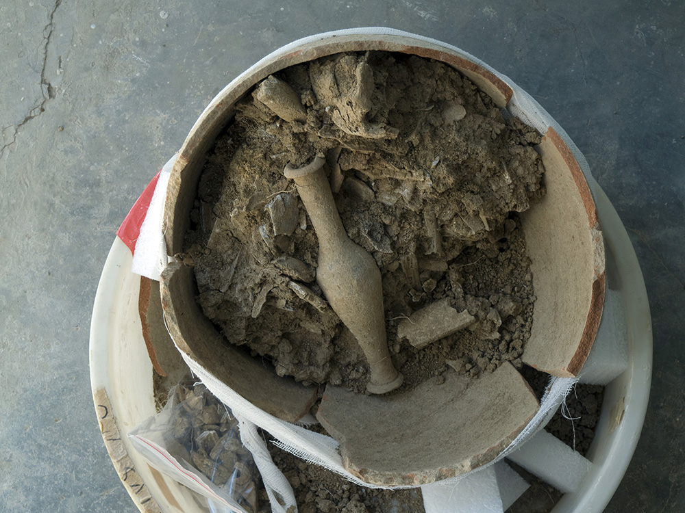
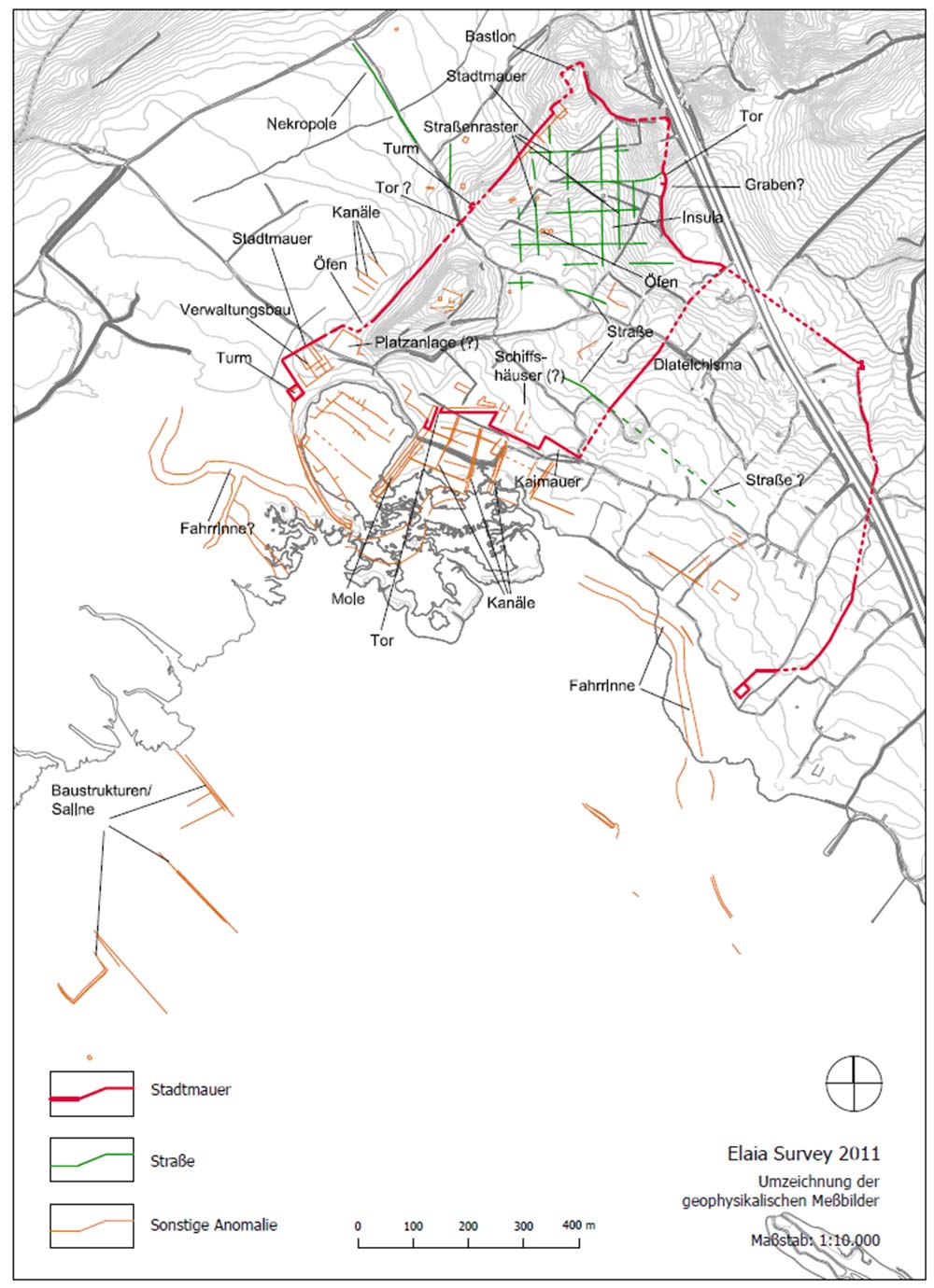
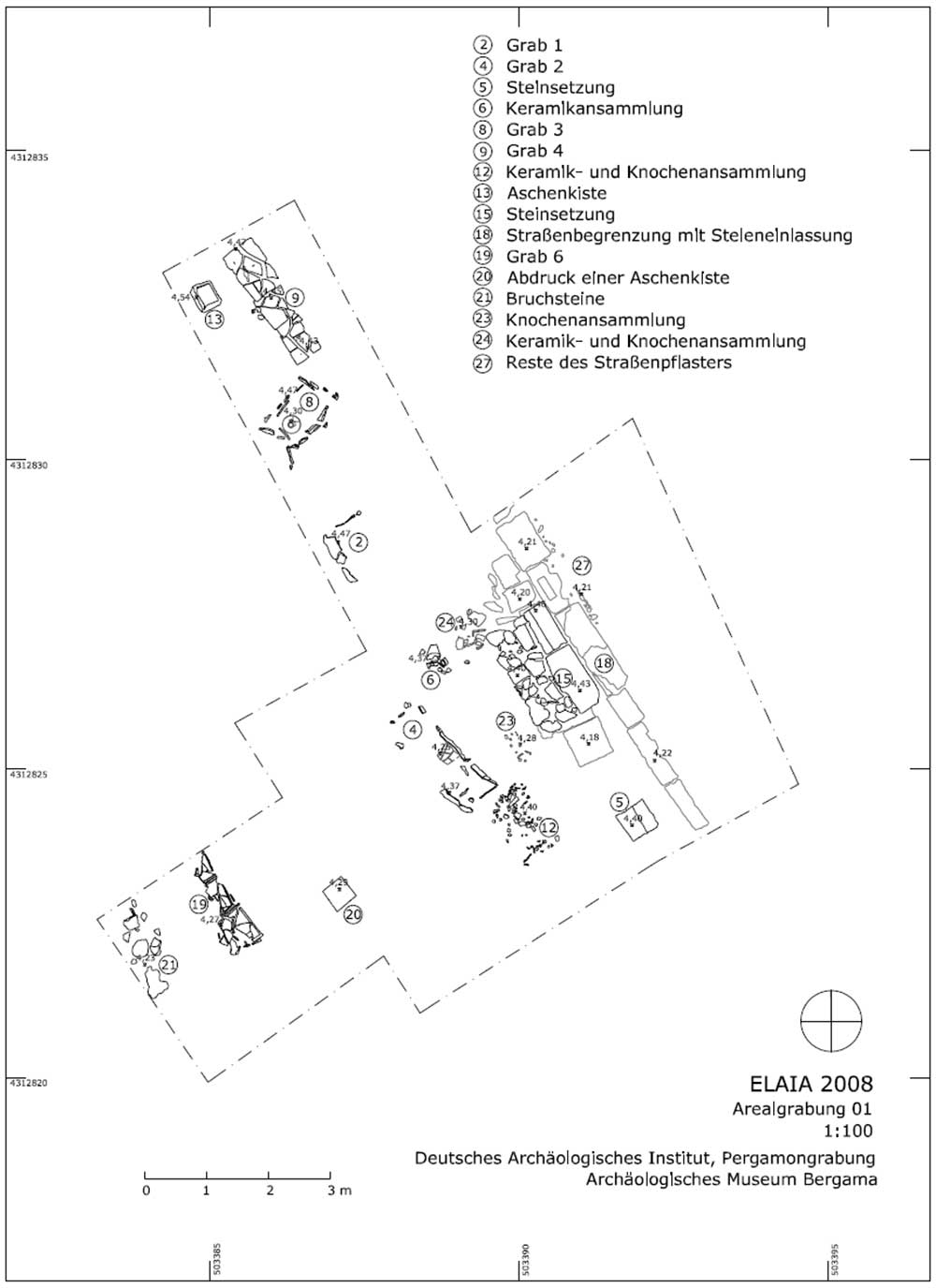
ELAIA
The ancient polis Elaia is situated at the bay of Çandarlı approximately 25 kilometers southwest of Pergamon. Due to its access to the sea and the connection with the coastal road which diverts to the valley of Kaikos (Bakır Çay) and to Pergamon, the city – which dates probably back to the Bronze Age – offered an ideal location for Pergamon´s main harbor.
Its advantages seem to have already been used by Eumenes I. (263–241 BC): Literary, epigraphic and numismatic evidence shows that Elaia became an important anchorage which served economic, military and communicative functions for Pergamon and the Attalids. This image had been both confirmed and thoroughly enlarged by multidisciplinary field studies between 2006 and 2011.
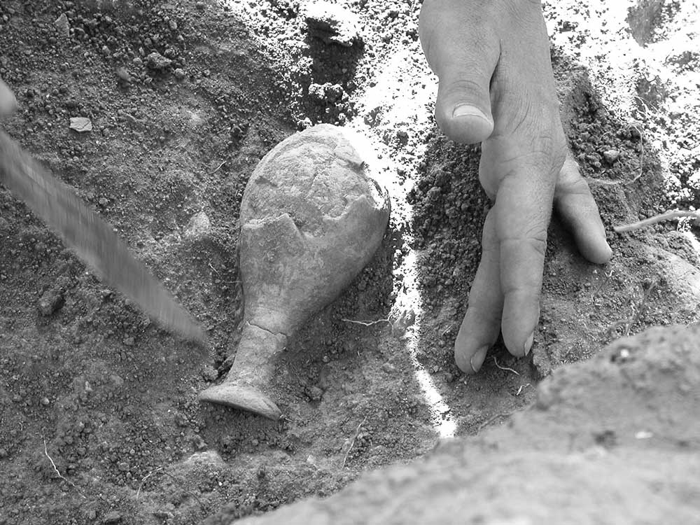
The activities also comprised three rescue excavations (in cooperation with the Bergama Museum) following illegal digs in the necropolis of Elaia. Two excavations of Late Classical and Hellenistic burials are further evaluated according to the objectives of the NekroPergEol-project. The examination of the human remains has already been finished.
KYME
The Greek Aeolian city of Kyme, north of Izmir and Phocaea, is explored since 1982 by an Italian archaeological mission founded by Sebastiana Lagona (University of Catania) and directed now by Antonio La Marca (University of Calabria). Within this scope a French archaeological mission in the Aeolis, led by Stéphane Verger with Rossella Pace (UMR 8546), is pursuing scientific studies on cemeteries and funerary monuments of the city since 2012.
A. Location of the city
The Aeolian city of Kyme is located in the town of Aliağa, on the western coast of Turkey, about fifty kilometers north of Izmir.
B. Two monumental tombs
The area under investigation covers the northern necropolis and within this territory several monumental tombs of the Greek era were recognized. The first was found in 1994 and consists of a built burial chamber that unfortunately has been looted. It has been completely excavated and studied in 2012. The second is a large burial mound visible on photographs of the site made by the Czechoslovak archaeological mission in 1930. It was not relocated until 2009, after looting had affected the entire central part of the monument. The identification and excavation of the central tomb took place during the 2012 campaign.
C. Large Late Archaic tumulus
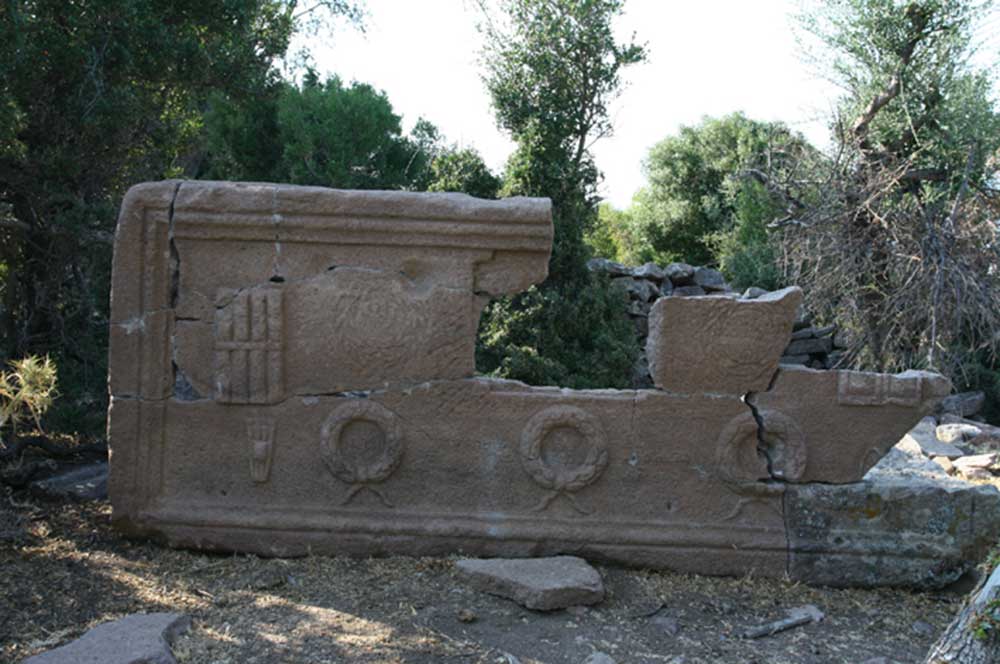
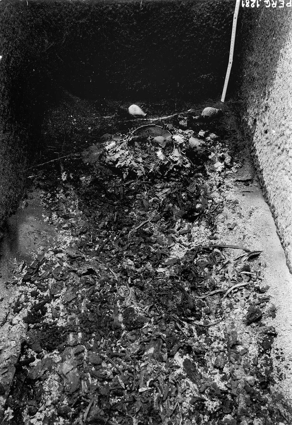
The mound is located atop a hill overlooking the entire city, its port and its territory, as well as the road from the Hermus Valley and Sardis that passes by the city of Larissa. It has a diameter of about 45 m and a height of 8 m. The dirt that the mound is made of, which was probably piled up of material on site, contained an abundant variety of local ceramic sherds from the late seventh and the first half of the sixth century BC and some fragments of Attic black-figure vases from the early fifth century BC. Two Persian bronze arrowheads with three fins and remains of several alabastra from the same period were found during the excavation. In the center of the mound was a large stone sarcophagus with a monolithic lid inserted into a cist grave built of orthostats and covered with reused ashlar blocks. The lid was pierced twice by looters and the interior was completely shattered. The bottom of the coffin was covered with a thin organic layer rich in remains of wood. In between them were found four small folded lead sheets of undetermined date. The only grave good that escaped the clandestine excavators is a gold ring with a carnelian showing an engraved erotic scene (the elongated figures of a couple locked in embrace); the ring has an antique repair. The style of the intaglio indicates a Late Archaic date. The absence of human bones raises questions about the possibility that we have to deal with a cenotaph.
D. Burial of an important personality of the time of the Persian Wars
The monumental tomb dates from the early decades of the fifth century BC. At that time, after the revolt of the cities of Ionia, Kyme returned under Persian control and was the naval base uniting the fleet of the Great King in 480 BC before his departure for Greece. This is also where the surviving vessels of the Salamis disaster spend the winter after the expedition's return. Given the large size of the tomb and its exceptional location, it can be assumed that it contained the burial of an important Greek or Persian personality of that era. Its complete study will shed new light on Kyme and the Aeolis under Persian rule.
PERGAMON
As royal seat of the Hellenistic dynasty of the Attalids and later on as Roman metropolis, Pergamon became one of the most prominent urban centers of the ancient world. Besides its political importance during the 3rd to 1st C BC the city was a cultural and religious center with a famous library, impressive architectural and artistic monuments and the supra-regionally important sanctuary of Asclepios. Unlike most other Hellenistic residence cities such as Alexandria and Antioch, Pergamon was never built over in modern times. Hence it offers an extraordinary potential for archaeological research. The same goes for the surrounding territory. Its examination is a vital precondition for our understanding of the genesis and the function of Pergamon as regional center and capital of a territorial state.
The scholarly importance of Pergamon is based on intensive archaeological excavations and research since almost 140 years. However, there are still unexplored areas. Until recently, graves and necropoleis featured prominently among them. During the last decade, however, a great deal of new insight has been gained by the evaluation of old data and the examination of predominantly Roman imperial burials. But there are still eminent desiderata particularly concerning Hellenistic funeral culture and the large grave mounds. In these areas, the NekroPergEol-project shall produce new evidence and knowledge.
The Yığma Tepe
Tumuli 2 and 3
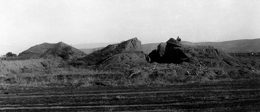
The Ilyas Tepe Tumulus
Les autres tumuli